


Soar Atlas satellite images reveal severe damage in the Fujairah Oil Industry Zone: tanks ablaze and one destroyed after drone incident
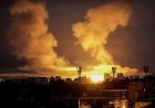
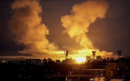
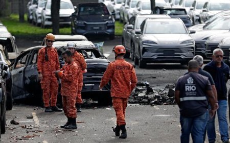
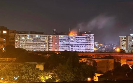
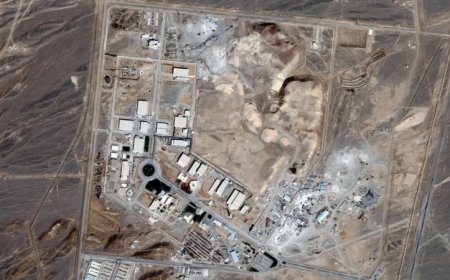
Soar Atlas has released new ultra-high-resolution satellite images of the Fujairah Oil Industry Zone in the United Arab Emirates, captured on March 5, 2026. The photos show at least two oil storage tanks ablaze, with large plumes of black smoke, workers applying water to cool adjacent tanks, and one tank already completely destroyed as a result of debris from an intercepted drone that started the fire.

- The geospatial analysis platform Soar Atlas today released ultra-high-resolution satellite images of the Fujairah Oil Industry Zone (FOIZ), captured on March 5, 2026, which confirm and detail the damage caused by the fire started by intercepted drone debris. The photos, obtained by high-definition commercial sensors, show an active emergency scene at the facility, one of the world's major oil storage and bunkering hubs.
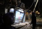
- In the analyzed images, at least two large oil storage tanks appear completely engulfed in intense flames, with dense plumes of black smoke rising vertically, visible even from orbit. Emergency teams and workers are seen directing water jets from hoses and firefighting vehicles to cool adjacent tanks in an attempt to prevent the fire from spreading to other structures. A third tank shows clear signs of total destruction: collapsed structure, impact crater, and absence of a roof, indicating that the fire or the initial shockwave compromised its integrity. The incident dates back to March 3, when UAE air defenses intercepted a hostile drone over the area. According to the Fujairah Media Office and Emirati authorities, debris from the interception fell into the industrial zone, starting the fire. Although the fire was initially brought under control and operations partially resumed, images from March 5th indicate that the fire persisted or reignited in critical areas, with more extensive damage than initially reported.
- FOIZ is strategic for the global oil trade, serving as a storage and transshipment point for millions of barrels per day, as well as a fuel hub for ships (bunkering). The fire and the partial destruction of tanks threaten disruptions in the energy supply chain, especially amidst the diversion of tankers to alternative routes via the Red Sea, already observed in recent days. Soar Atlas, known for cataloging and making available maps and satellite images from public and commercial sources, included before/after comparisons in its publication, highlighting the extent of the devastation.
- Open-source intelligence (OSINT) analysts and energy experts confirm that the images corroborate reports of multiple waves of drone and missile attacks against Gulf assets, attributed to Iran or allied groups. UAE authorities have not released updated estimates of financial losses or the volume of oil affected, but reiterated that containment teams remain on site and that there is no immediate risk to the civilian population. The incident reinforces the vulnerability of critical infrastructure in a context of regional conflict, with potential impacts on global energy prices and the stability of shipping lanes.
What's Your Reaction?